
- Packages
- Destination
-
Travel Attraction
By Category
Top Attraction

- Agents
- Car Rentals
- Hotels
(Pick-up Day): Drive from NJP/Bagdogra to Sepi
Drive Duration: 7 hours | Drive Distance: 130 km
Altitude: 6,400 ft
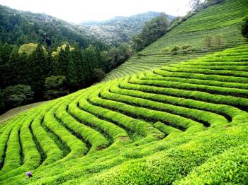
Highlights: The tea estates of Darjeeling. Hot momos and Thukpa for lunch. Pretty settlements along the way before reaching Sepi.
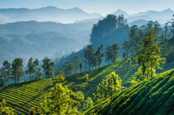
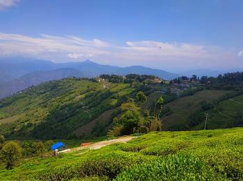
The drive from Bagdogra Airport/NJP Railway Station to Sepi is what a typical ride in a hill station is like. The roads meander through the famous Darjeeling tea estates and small villages on the hills. Enjoy the views from your cab as you start to gain altitude.
Along the way, you will first come across Mirik, which is a popular tourist destination. Some distance beyond Mirik, stop around 1.00-2.00 PM for lunch. Try some authentic momos (dumplings) and Thukpa (noodle soup) here. You will find these dishes in almost every other eatery on this route. In a few teahouses, you are likely to find more traditional food like Gandruk, Churpi (Yak Cheese), Ningro and the famous chilli Dalle Khursani (Some of these might require prior intimation)
Post lunch the cab resumes on the uphill roads to Sepi. Along the way, you will pass through Sukhiapokhri, Dhotrey, and Rimbik. All of these are very beautiful settlements and blend into the surrounding tranquillity far from the hustle and bustle of city life.
We believe that Sepi is our prettiest base camp! The place has abundant spots with tree groves, moss-covered rock faces, and ferns sprouting from every nook and corner.
Srikhola spring cuts through the village and human settlement bestows high and low on the landscape. It is a place worthy of putting up on tourism postcards. If this doesn’t add enough character to the place, according to the locals, some spots here are haunted! Talk about getting more than what you asked for.
Activities : Mountaineering
Trek from Sepi to Samanden
Trek Duration: 7-8 hours | Trek Distance: 14 km
Altitude Gain: ⇗ 1,360 ft (6,400 ft to 7,760 ft)
Difficulty: Moderate, mostly ascend with some steep sections. Descend after Ramam.
Highlights: Trek through a dense canopy of pine, oak and rhododendron forests.
Sepi is the base camp for this route and it’s just across the suspension bridge which happens to be a landmark and can be considered the starting point of the actual trek. After a good night’s rest here, it’s time to lace up your boots and head out on your journey.
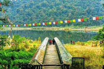
With the prayer flags fluttering against the wind, walking on this suspension bridge itself is a very nice experience. Enjoy the small vibrations as you cross this bridge. Get to hear about the five elements of these prayer flags from your guide.
You warm-up for the day by walking to Ramam which is about 3.5 km away. There is a constructed road for the most part till Ramam and it meanders through several dwellings and step-cut fields on either side of the road. These however start to reduce as you proceed further on the route.
It takes approximately 3 hours to reach Ramam and the road to Ramam is all ascent with some steep sections. It’s recommended to keep an easy pace and take rest as needed. It builds momentum and will allow your leg muscles to adapt to the terrain, exposed to the sun. Raman is a good stop point to rest a bit longer to replenish your energy. Now would be a good opportunity to level up your water canteens.
Your resume for Samanden after a short break. About 5-10 minutes later, the village huts are left behind and you are greeted with a small clearing surrounded by the thick pine forests foreboding the next section of the route. You also see tall Rhodos on this trail interspersed with tall pine trees. In Spring, these trees flower in lovely red that makes the entire trail colourful. You will also notice many orchids, ferns and mushrooms on the ground and on the trees.
Just across the clearing, you enter the forests and an emerald hue immediately surrounds you. For the next 6 km, you are completely traversing through a dense forest till you reach a bridge.
For the first 15 minutes, you take a steep ascent. Soon after, you reach a place where there are stone benches that are etched with the names of the locals who are no more. The noble thought behind this is that these locals who have passed away still get to serve the passers-by on the trail by providing them with a place to rest.
Just before you reach Samanden, take a right and you will enter one of the enchanted forests of this region. Once you hit the trail back to Samanden, you wlll find a stone at Sopedonga. This is a stone that is said to mark the boundary between Yetiland and Humanland after a war between humans and Yeti.
The trail eases out to a gradual climb 10 minutes later, and finally, you arrive at a vast clearing, having gradual undulating terrain dotted with farm fields and wooden huts, called Samanden. The beauty of this place is no less than the villages in the Swiss Alps.
The clearing is bordered by tall pine trees and the huts resemble Victorian architecture. One of these huts is your stay for the night where you are treated with very generous hospitality. Soak in the peace and simplicity of this place before you retire for the night wishing you owned a small hut in this quaint little village.
Activities : Mountaineering
Trek from Samanden to Molley
Trek Duration: 7 hours | Trek Distance: 10 km
Altitude Gain: ⇗ 3,460 ft (7760 ft to 11,220 ft)
Difficulty: Difficult, steep ascent till Molley with very less flat terrain.
Highlights: A chance to spot a variety of flora and fauna, along with the rare Red Panda in the bamboo forest.
Today is going to be a challenging day as the entire route from Samanden to Molley is a steep climb. This is the day you exert the maximum and for the longest duration. However, the beauty of the trail lifts your spirits and motivates you to keep going. If there is magic in the forests, today is the day to experience it. Today, you will trek through three distinct groups of forests - each unique in its own way.
You climb almost 3,500 ft. In mountain terms, that is a substantial elevation gain. On top of that, you have no water sources on the route.
The entire route to Molley is actually through a dense forest. You will start the route in the section of the forest which is mostly of pine and oak trees. It starts with the Green Oak slowly giving way to Golden Oak as you keep climbing higher. Since these forests are comparatively at a lower altitude there is a high possibility of crossing your paths with some rare Himalayan wildlife.
Asian Black Bears are known to dwell in these forests and several trekkers have even had close encounters with them. You can identify them with the distinct moon-shaped patch of white hair on their chest. They are generally not aggressive and leave your path if you are approaching them.
In the extremely rare chance you spot a mother bear with cubs, it is best to stay still and keep your distance or retreat slowly till she has gone it's way. There are other wild animals too in the region but as you go higher up, the chances of encountering them go down. Apart from mammals, there are several different species of birds as well that reside in these forests.
As you proceed further you also pass through dense bamboo forests as well. The bamboo groves flank you on either side of the route. In some parts, the bamboo forest gets so dense that you can hardly see further than a few meters into the jungle.
All you see are green sticks shooting out from the ground and arching over the route. It is in these very forests that, if you are lucky enough, you sight one of the shyest creatures from the endemic Himalayan fauna – The elusive and endangered Red Panda. They forage in these forests as their diet primarily consists of bamboo shoots. You have to walk with as little noise as possible to avoid scaring them away if they are in the vicinity and keep your eyes open. It is surreal to watch them in their natural habitat and one of the best experiences to carry back home.
While walking in the forest, you get to see mushrooms and fungi of many different colours. The trees are so tall with trunks so large, you’ll need 7-8 people just to cover their circumference!
After a few hours, the forest transitions to one full of Bamboo trees. Even here, the forest is so thick and dense with canopies, the sunlight barely touches the forest floor. A few undulating trails later, the Rhododendron belt begins.
After a long day of walking through the forest, you finally emerge from the forest. Walk another 200 metres to reach your camping site near Molley. The campsite at Molley is a stark contrast to the forest that you left behind. It is bereft of vegetation and is where the true alpine grasslands for the trail start.
There’s a forest hut at Molley where you can find some snacks. You have a hearty dinner and retire for the night in pitched tents here. You will find yourself reminiscing about the adventure you took during the day and the excitement you felt.
Once you reach Molley, walk 500 meters towards Sabargram to catch the alpenglow on the Kanchenjunga.
Activities : Mountaineering
Trek from Molley to Sabargram via Phalut
Trek Duration: 7-8 hours | Trek Distance: 15 km
Altitude Gain and Loss: ⇗ 590 ft; ⇘ 360 ft (11,220 ft to 11,450 ft via 11,810 ft)
Difficulty: Easy, mostly level walks interspersed with a few ascents and descents.
Highlights: View of the Sleeping Buddha range
Today, you trek above the treeline and hit the ridge where if the weather is good, you will catch the views of the 4 tallest peaks of the world.
The trail from Molley to Phalut is a 6 km straight route that almost touches Nepal on your left. This will take you about 2.5 hours to cover. There are a series of gradual descents, steep ascents and level field walks, each coming in intervals of about 15 minutes. After this is half a km flat meadow walk followed by 1 km of a steep climb, which can be negotiated by taking shortcuts. Look out for the trekkers’ hut which the locals call Phalut Bungla, on your way. From this point, you will reach Phalut by climbing steadily for about half an hour.
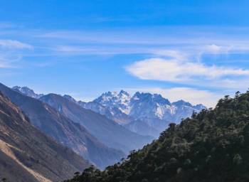
The route offers one of the finest views of the Kanchenjunga massif and all the other peaks around it collectively known as the ‘Sleeping Buddha’. The peaks that you can see from the left are Kumbhakarna, Kanchenjunga and Simvo in the background. Below Kanchenjunga are Kokthang, Rathong, Frey, South Kabru, North Kabru, Kabru Forked, Goecha and the ridge of Pandim just ahead of Simvo. The depression between the ridgeline of Goecha and Pandim is the Goecha La, which is a popular and beautiful trek in Sikkim. It is amazing to witness such providence that these mountains, formed billions of years ago, and how they collectively appear to a person from distance, hold a near-perfect resemblance to the enlightened one himself – The Buddha in a resting position. Your first look at the ‘Sleeping Buddha’ is spellbinding and sends you into a spiritual trance. It gets imprinted on your psyche and remains there. The viewpoint is on the hillock to your left after reaching Phalut. Reach there early to get magnificent views of the entire panorama of mountains and peaks.
Phalut is a small grassland with minimal or no vegetation. There is only an SSB camp, a forest guest house and a GTA (Gorkhaland Territorial Administration) trekker’s hut. You may chance upon wild Yaks grazing around the hillock by the GTA hut. You can take a quick stroll up the hillock where you will be standing on the India-Nepal border marked by a boundary marker. Standing here you have a magnificent view of the hills and valleys on the Nepal side. Though this is a remote place, you get the closest views of the entire panorama. From here, the Sleeping Buddha range is at an aerie distance of only 38 km!
After spending an hour or hour and a half exploring the place, you now start to trail via the same route back to Sabargram to rest for the night at the campsite there.
Activities : Mountaineering
Trek from Sabargram to Sandakphu
Duration: 7 hours | Trek Distance: 12 km
Altitude Gain: ⇗ 480 ft (11,450 ft to 11,930 ft)
Difficulty: Moderate. Hillocks with ascents and descents of varying steepness.
Highlights: Ridge walk with the Kanchenjunga range accompanying you throughout.
The morning after you have rested at Sabargram, you wake up to a refreshing morning. Your legs may be fatigued from the stress of the previous two days.
However, do not miss the experience of the sunrise at Sabargram where you get to witness the sun rising above the floating clouds.
Once you get your breakfast and morning tea in, you will be good to go. The crisp and cold morning breeze fills up your lungs as you get ready for the journey today. It’s going to be a long day but not very stressful. The route starts at the same point as the last day but instead of going towards Phalut, you walk in the opposite direction. The route runs along the Singalila ridge on the actual India-Nepal border all through to the Sandakphu top. You come across several trodden paths crisscrossing the terrain. All look more or less the same. The most defined and logical route is the one leading to Sandakphu.
The trails are the best you will encounter on this trek in terms of unique scenery. The landscape is dotted with tall shafts of pine trees which appear to have been cursed and petrified with pointed tops and little to no branches. Some appear to have been burned from the inside out indicative of lightning strikes. The route has an immense concentration of rhododendron in full bloom in April and May. There are small wooden recluses along the route built and used by local cattle herders that surely add to the serenity of the place. The backdrop of the landscape is adorned by the Buddha in his eternal sleep. It is as if you are walking through a three-dimensional painting.
Halfway through the route, you will arrive at a small pond called Kaly Pokhry where there’s a trekker’s hut too. This place is called Thokum, where you’ll have your lunch. This however shouldn’t be confused with Kali Pokhri which comes on another route to Sandakphu from Manebhanjan. You can rest here for a while before proceeding further. Some trails branch off into Nepal. The route also has concentrations of Rhodo shrubs which bloom in white and pink in April and May. Unlike the red flowers which are medicinal, the white and pink rhodos are poisonous and must not be consumed.
As a thumb rule remember that India is on your left-hand side of the route you started walking on. Therefore on any forks that you come on the way, you stick to the one forking left in the southwest direction as the crow flies. You will arrive at Aal by late afternoon.
Sandakphu lies 1 km ahead of Aal. It shouldn’t take more than 20 minutes to reach here. The viewpoint is up a small hillock a mere 100 meters before the cluster of houses and shelters at Sandakphu.
Sandakphu is your campsite. You have to catch the sunset from the Sandakphu top and therefore can stroll up to Sandakphu after keeping your bags at the camping site. Evenings bring up the rolling clouds from the foothills and it’s a mesmerizing view. The temperature starts to drop rapidly after dark. But step outside in the night and spend time watching the milky way, our nearby galaxies, nebulas and planets.
Activities : Mountaineering
Trek from Sandakphu to Gurdum
Trek Duration: 7 hours | Trek Distance: 8.5 km
Altitude Gain and Loss: ⇘ 4,530 ft (11,930 ft to 7,400 ft)
Difficulty: Easy. Complete descend with a gradual decline. Today won’t be as tiring as previous days as you will descend all through till Gurdum. You will get the best views of Kanchenjunga while trekking to Phalut.
Highlights: Panoramic view of some of the tallest mountain ranges in the world.
You wake up early to catch some amazing panoramic views of the surrounding landscape during sunrise. You would not want to miss the first rays of the sun falling on the mountain peaks as the sun comes up. It lights up the distant peaks with a crimson-golden hue, which is an amazing sight to behold. It’s one of the finest examples of the natural beauty you get to witness in the Himalayas.
The main attraction of this spot is the 180-degree views of one of the world’s most coveted panoramas: Makalu, Lhotse, Everest, Nuptse, Baruntse, Chamling and Chomo Lonzo. Three sister peaks stand tall towards the north and of course, the Sleeping Buddha lies before you. Towards the east, you see the highest ranges of Bhutan, where Chomolhari, the highest peak, rises above all the others.
After you have captured the images in your memory and cameras you proceed further on the route. Using the thumb rule, you start descending on the left trail at the fork you come at after Sherpa Chalet Hotel and Sunrise Hotel. The right trail leads you down to Kalipokhri and you don’t have to take that route. From here on, the trail is over a ridge and directly leads to Gurdum. It takes a steady 2 hours to walk up and down a few hillocks with gentle gradients to reach a small pond where you settle down for lunch and rest a bit. Before reaching Gurdum, you will pass through 3 stupas where we will stop for a break.
After that, it’s a complete descent till Gurdum which is about 3.5 - 4 km away, which takes another 1.5 - 2 hours. As you come closer to Gurdum, you will again start seeing the bamboo vegetation which will tell you that your destination is not far. Gurdum is yet another quaint village just like Samanden. Although not as beautiful as Samanden it has its rustic charm and provides you with an excellent place to finally unwind and take proper rest. Your stay is arranged for at a local homestay run by the Nepali folks residing here. This is called Gurdum Homestay. Our trekkers love staying at this homestay because the hosts are warm and welcoming. The hospitality that you receive at these homestays in general is very basic but outshines a lot of commercial hotels.
Activities : Mountaineering
Trek from Gurdum to Sepi. Drive from Sepi to NJP / Bagdogra
Trek Duration: 3 hours | Trek Distance: 4 km
Drive Duration: 7 hours | Drive Distance: 130 km
Altitude Loss: ⇘ 1,000 ft (7,400 ft to 6,400 ft)
Highlights: Scenic views of village settlements as you descend to Sepi. The drive back to NJP / Bagdogra takes you through the same route you had taken on Day 1.
The next morning again is going to be a complete descent which passes through the same sort of vegetation setting as on day 2 of the trek. Your destination is the same place you started your trek from. It’s about 4 km from Gurdum and you will reach there by mid-noon. Along the way, you will start seeing more and more of the village houses as you proceed towards the Sepi suspension bridge. Routes coming from different directions converge as tributaries of a major river and lead you to the Sepi bridge.
Once you reach the destination, you have your lunch and depart for Bagdogra airport or NJP railway station.
Activities : Mountaineering
* 20% Advance Percentage of total booking amount
* Upon cancellation, refund will be made after deducting the Retention Amount.
We deal in Tour Operator Services. Know more..
Gangtok - Pelling - Yumthang - Lachung
8 Days / 7 Nights
10D Gangtok - Lachen - Lachung - Pelling - Darjeeling Tour
Gangtok - Darjeeling - Pelling - Lachung - Lachen
10 Days / 9 Nights

Srinagar - Anantnag - Jammu - Baramulla
7 Days / 6 Nights

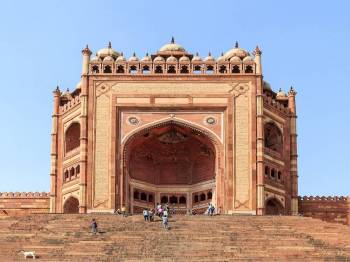
Amritsar Chandigarh Delhi Agra Family Package
New Delhi - Agra - Vrindavan - Mathura - Amritsar
7 Days / 6 Nights

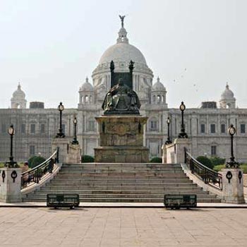
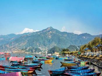
9 Nights 10 Days Nepal Tour Package - 1
Gangtok - Darjeeling - Kathmandu - Pokhara - Goa City
10 Days / 9 Nights
9 Nights - 10 Days Nepal Tour Package
Gangtok - Darjeeling - Kathmandu - Pokhara - Goa City
10 Days / 9 Nights
10 Days Kathmandu - Pokhara - Darjeeling - Gangtok Tour
Gangtok - Darjeeling - Kathmandu - Pokhara
10 Days / 9 Nights
10 Days Kathmandu - Pokhara - Darjeeling - Gangtok Tour
Gangtok - Darjeeling - Kathmandu - Pokhara
10 Days / 9 Nights
Sikkim - Darjeeling - Gangtok 8N Tour Package
Gangtok - Darjeeling - Pelling - Namchi
9 Days / 8 Nights
5N View Darjeeling - Kalimpong - Gangtok In Budget
Gangtok - Darjeeling - Kalimpong
6 Days / 5 Nights
Sikkim And Darjeeling Tour Package 6 Night - 7 Days
Gangtok - Darjeeling - Pelling
7 Days / 6 Nights
Gangtok - Darjeeling - Pelling 5N 6D Tour
Gangtok - Darjeeling - Pelling - Lachung
6 Days / 5 Nights