16 Nights / 17 Days
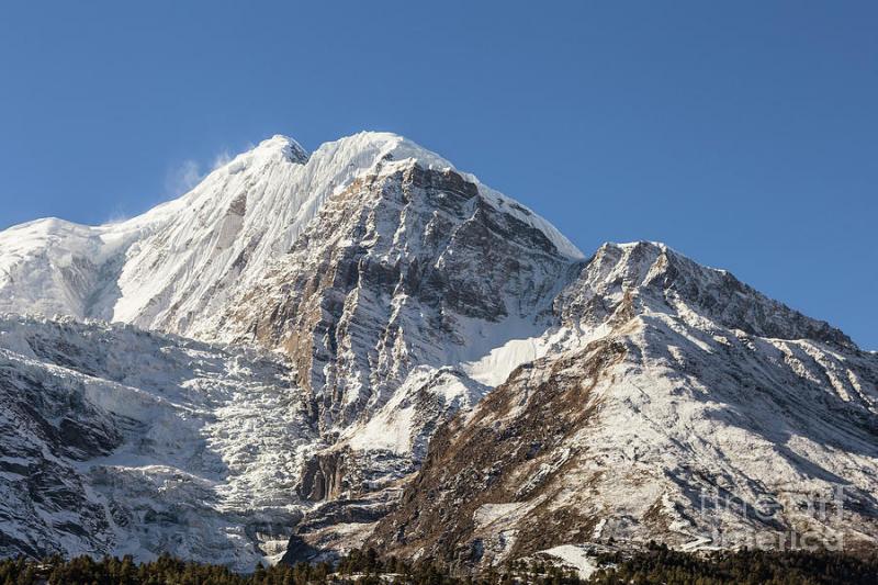
Annapurna circuit trek-hike through the Annapurna, witness the diverse ethnic-culture, lifestyles, and scenery on the shadow of the unbelievable mountain vistas.
Annapurna Circuit trek is classic rugged two-week adventure holiday leads you through the diverse and varied landscapes of hills and mountains, the diverse cultures, stunning sceneries and climatic zones. This trek has so much to offer, from the barren topography of the Tibetan plateau to the deepest gorge in the world, Kali Gandaki gorge and the dramatic scenery of the Annapurna massif, we are in for some pampering in this extremely beautiful region steeped in history, culture, and tradition.
After you land in Nepal, you cannot miss exploring the ancient city of Kathmandu, where we will take you to explore the age-old monuments of Patan and Bhaktapur. The next day, we embark on our journey on a minibus and drive to the road ahead to Bhulbule - and to the lush terrace fields of the lower Marsayangdi River valley. We set foot on this trail and make our way alongside this ancient river as it cuts through the main Himalayan chain. Our companion during this trek will be the bamboo and tropical vegetation's. Soon the temperate climate makes its way to the arid desert and barren conditions of the Manang district, home to century's old Buddhist temples, medieval villages and the native people, the Nyeshangs.
We set our foot on the footsteps of the ancient salt traders over the highest pass in the world, the Thorong La pass. At 5,416m it is the highest trekking pass on earth and the spectacle from the top of the Mt. Dhaulagiri (8,167m) are just stupendous. On the way down to deepest gorge in the world, the Kali Gandaki gorge, we make a short visit to the holy temple of Muktinath, a sacred site for both Hindus and Buddhists. Witness how the locals indulge themselves while devoting themselves to God.
As we continue our descent, we arrive at Kagbeni and the junction of the Jhong Khola and Kali Gandaki Rivers (2,800). Eventually, we will end up in the deepest valley in the world. Surrounding us to the east is the splendid Annapurna (8,031m) which majestically sits astride the gorge, and on the west lies the towering peak of Dhaulagiri at 8,167m. Like sentinels of the rapidly flowing Kali Gandaki River, they guide us south towards the lush lowlands. We end our adventure trekking at Jomsom, the district headquarter of Upper Mustang and Manang. We fly to Pokhara, or if you have a few days more to explore then we keep continue walking from Jomsom down to Tatopani and Ghorepani Poon Hill. As we descend through the trails, we will be surrounded by the cool winds of the pine and rhododendron forests which will lead us to the natural hot springs. Soak away the dust of the trail, revitalize, rejuvenate and relax yourselves. We also make a short ascent to the peak of the unmissable Poon Hill for the stunning and great views when the sun rises and the sunrays gently caress the mountain peaks. A final reminder that you have just circumnavigated one of the most breath-taking mountain ranges on earth.Sightseeing or any extra activities except the above program
Personal nature expenses
Bar bill and all kind of drinks
Rescue & Evacuation
Gratitude (tip) for staff
Upon your arrival at Kathmandu airport, one of our trek leaders will greet you and transfer to hotel. After a rest and refreshment we invite you to join the welcome dinner at a typical Nepali restaurant. Enjoy the local meal and drinks with a short briefing of Annapurna circuit trekking. Overnight at hotel.
Breakfast will be at hotel, today is trek preparation and packing day or if you wish to see some of the historical places of medieval Kathmandu, we can organize a sightseeing tour of Kathmandu valley. The major places in the tour include Kathmandu Durbar square, Pasupatinath temple, Monkey temple and bouddhanath stupa. Overnight at hotel.
We embark local bus drive from Kathmandu to Besisahar then continue to Bulbule. Leaving Kathmandu valley we are driven on the highway along the Trisuli River until Mugling. From Mugling we go westwards along the Marshyangdi River. We will be trekking along the Marshyangdi River valley until the day we go over the Thorung la pass 5415m. From Besisahar we drive another two hours to reach Bulbule. We have first glimpse of stunning Manaslu range from Khudi village. Also, we can relax to the sound of the mighty Marshyandi River. Overnight at guest house.
Leaving Khudi, we pass by a local school on the right side. We will have to stop at Bulbule where there is a check post for the Annapurna Conservation Area Project (ACAP). We cross a steel bridge over the Marshyangdi River which serves as a vital connection between both sides of the village. We continue passing mostly terrace rice fields until the village of Ngadi (The birth place of Late Dr. Harka Gurung, a popular naturalist). We might stop here for a lunch, after lunch we will cross another large suspension bridge over the Ngadi River where the trail begins to ascent straying away from the Marshyangdi River through a forested area. The last hour is a pretty steep climb to Bahundanda (Hill of Brahmins) through cultivated fields. Overnight at guest house.
Leaving Bahundanda, we will descend on several stone steps. The farmers can harvest 2-3 crops a year in these lowlands depending on the rainfall. The path levels off and from here the small villages of Sildhunga and Tadring and be seen on the hillside opposite the valley. Contouring along the undulating path until the descent to the small settlement of Syange. We will have a rest stop before the descent at Ghermu phant for a drink and to admire an impressive water fall on the opposite side of the valley. We need to cross a suspension bridge across the Marshyangdi. We will notice the sides narrowing and getting steeper while walking up the valley. We may pass mule trains along the way. From here is a steep climb to the village of Jagat. A series of up and down walk brings us to Chamje, the final stop for the night. Overnight at guest house.
We cross a suspension bridge to the east side of the Marshyangdi soon after leaving Chamje. We continue along a series of overhanging rock formations. The path begins to traverse a broad ledge after a short climb. We then come to a series of stone steps as we pass a couple of tea shops while going uphill. The trail evens out after a while and we will cross though an archway- which is the gateway to Tal and the Manang district. Tal means lake in Nepali. We can see a broad expanse where a lake used to be. The Tibetan influence gets more evident from here on with Chortens, Gompas and the architecture of the buildings. The trail from Tal levels out for a while, a welcome relief for our legs. We will cross a bridge back to the West of the Marshyangdi after about an hour later. We can see the old trail on the other side which was recently abandoned due landslides. The trail continues up wards until the village of Dharapani where there is a police check post. Bagarchhap is only another 45 minutes walk from Jagat(1920m). Overnight at guest house in Bagarchhap.
Great views of Mt. Annapurna II (7937m) and Mt. Lamjung Himal (Mountain) (6932m) greet you as we proceed up the valley. We reach the village of Danakyu after 30 minutes. If we look behind the lofty peaks of Mt. Manaslu 8156m, the eight highest mountains in the world and Peak 29 (7833m) could be visible on the clear days. There is a steep climb for about an hour through Pine and Fir forest with spectacular scenery. We may see Langur monkeys in the forest. We will reach Timang village with spectacular views of Manaslu 8156m. Continuing on a flattish path and a river late the village of Thanchok is reach. The towering Annapurna II (7937m) is incredible further up the trail. The path rejoins the main trail while descending through woodland down to Koto which sits in the shadow of Annapurna II 7937m. The Nar Khola (river) from the recently opened valleys of Nar and Phu joins the Marshyangdi from the right side of the valley. Chame which is the district headquarters of Manang is a short walk from here. There are excellent views of Lamjung Himal 6932m from here. Overnight at guest house.
This day is a shorter trek to Pisang. However as it is so beautiful most trekkers take their time to admire the scenery and take lots of photographs. We will pass through a series of mani walls. The trail is pretty even until the apple orchards of Brathang. The trail heads uphill for about 45 minutes through forest, leveling off before reaching a suspension bridge. A moderate climb follows after crossing the bridge through a forest consisting of Juniper, Pine and Fir. The valley begins to broaden and Pisang Peak 6091m stands out in front of us. We pass a couple of small lakes where sometimes birds can be seen wading. Pisang is divided into upper and lower. Overnight at guesthouse.
There are 2 options on the days a low route 5 hours or the high route 7-8 hours. If we take the lower, less strenuous route, the path out of the valley is pretty level and then once out of the valley we begin to contour round to our left and climb up onto a ridge. The view from this ridge is breathtaking looking down into the Manang valley and our heart says we spend the whole day here to enjoy it! Dropping to the valley floor the path is wide and dusty. We will have noticed that the scenery here is becoming more arid, the air drier and the wind colder. Annapurna III (7,555m) rises to the left and passing through the village of Hongde we will see the deserted remains of the old village on its outskirts. The path then rises gradually and takes us into the next valley. After a couple of hours walk we will pass through the village of Braga, just 30 minutes walk from Manang.
The High route
If you are feeling fit and energetic then the high route on the east bank of the Marshyangdi is strenuous but well worth the effort. We cross the river out of Pisang village and then take a reasonably level path through scrub land, passing a small picturesque lake on our right. We then pass a long mani wall and descend to cross a stream and begin a strenuous zigzagging climb up to the village of Ghyaru (3,673m). A welcome tea shop is the first house we reach in the village. It is well worth climbing up to visit the Gompa at the top of the village. The views from here of Annapurna II and Annapurna IV are totally stunning. From Ghyaru we continue up the valley on a wonderful high level trail, passing the ruins of a castle set on a promontory, with views both ways up and down the valley. We then arrive at the village of Ngawal (3,650m) where there is a large newly built Gompa up to the right. We leave the village near a long mani wall. Finally we descend back to the valley floor and rejoin the main trail to continue to Braga and Manang. Overnight at guest house.
It is essential to spend time for acclimatization in this area. There are splendid views of the peaks from both Manang and Braga villages. Manang is a large village situated on a rise immediately across from the huge Gangapurna glacier. A beautiful emerald lake lies at its foot. There are plenty of good walks in the area and for at least a couple of hours we should try to climb as high as possible above the village. Side trips are recommended to a small summit with prayer flags about an hour above Braga village, or up the ridge behind Manang village, or to a viewpoint above the lake opposite Manang Village. It is also possible to walk up the valley towards Tilicho Lake to the village of Khangsar. In addition it is worth visiting the Manang Gompa or, if it is open, visit the clinic run by the Himalayan Rescue Association, they often have conversations about altitude in the afternoon. There are also shops to explore for souvenirs. Overnight at guest house.
Despite being shorter day, it is essential for acclimatization to stop between Manang and Thorong Phedi. We will leave Manang and take about 30 minutes to reach the upper village. After this we contour round the hillside and gain great views of the Grand barrier, the high ridge between Roc Noir and Nilgiri named by French climber Maurice Herzog. Below the grand barrier you will see down the Khangsar valley which leads up to Tilicho Lake. Passing the hamlet of Gunsang we continue through the barren upper reaches of the Manang valley. The path ascends gradually but is still hard work due to the increased altitude. We will arrive at Yak Kharka and have lunch there. In the afternoon we could take a walk further up the valley or climb the ridge behind the village if we make it to the top of the ridge there are great views of the north of the Annapurna range. Either of these walks would help with acclimatization. Even if we only venture a short way above the camp there is the chance to see the large flocks of blue sheep which inhabit this area. Either of these walks would help with acclimatization.
Again this is a short day, yet essential for proper acclimatization. Leaving Yak Kharka we will pass through the small collection of lodges known as Letdar. We will take a high route, which winds its way around the eastern side of the Thorong valley, before dropping down to the valley floor. Crossing the river there is a short but sharp climb to Thorong Phedi. Phedi means foot of the hill and while it is the jumping off point for crossing the Thorong La it is not the prettiest place in the world! In the afternoon it is worth walking up beyond the first notch to the collection of huts known as upper base camp, as an acclimatization walk, and then continuing up to the right to a small peak for superb all round views. Watch out for blue sheep here. Overnight at guest house.
Starting at dawn or thereabouts we first ascend steeply for one hour to a rock ledge and notch at 4,679m, then continue up along an ascending and undulating trail. This ascent will seem endless and be warned there are several false summits - but there are great views back down the valley as we go. Finally, after anything from 3 to 5 hours, we arrive at the top of the Thorong La (5,415m) with its large cairn and many prayer flags. We will have spectacular views of the Annapurna Range to the south and the Mukut Himal bordering Dolpo to the west. The peak immediately south of the pass is Thorong Peak this is a trekker's peak and we may see people climbing here. We will probably not want to linger too long at the pass as it can be very cold and we will probably be feeling the effects of altitude. The descent to Muktinath is very steep and takes some 3 to 4 hours. This is where we might appreciate having walking poles to take the strain off the knees! During the descent there are splendid views of Dhaulagiri (8,175m) and Tukuche Peak (6,920m) and all the way down into the valley of the Kali Gandaki below. Finally we see the buildings of Muktinath coming in to view. We bypass the enclosure round the famous temples and descend to the main village, which is actually called Ranipauwa and not Muktinath, a name which technically refers just to the temple. Overnight at guest house.
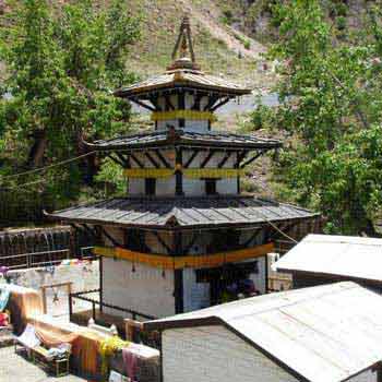
Muktinath is a sacred pilgrimage site for both Hindus and Buddhists. Before breakfast, we pay our visit to temple of Vishnu and Gopma. Descending from Muktinath (also known as Ranipauwa village) down the steep and barren hillside, we tumble down toward Kagbeni and then to Jomsom. The trail today is quite surreal as we trek along a plateau above Kali Gandaki, the world's deepest gorge. The barren landscape of this region looks like Tibet. Overnight at guesthouse.
After breakfast, we will fly from Jomsom to Pokhara, 25 minutes flight provides amazing mountain views. It is also known as mountain flight. Arrive at Pokhara airport, transfer to hotel. Overnight with breakfast. (Please note that some time flight from Jomsom to Pokhara gets delay or cancel for one or two days in that case we will arrange a jeep or bus (depending on group size) to come to Pokhara. And your flight fare will be covering the drive if you are minimum 4 people. If your group size is 1 to 3 people then you will have to pay some extra cost on top of the flight fare to come to Pokhara by a private jeep.)
After breakfast at hotel in Pokhara, we take a scenic bus journey to Kathmandu or if we are doing a wildlife safari then we head toward Chitwan National park. We can even fly from Pokhara to Kathmandu. In the evening, we celebrate our trek with the farewell dinner at a typical Nepali restaurant with live culture show. Overnight at hotel.
After breakfast, we will drop you to international airport for your flight back to home. Wish you have a safe and sound flight back home. Hope to see you again in the future.
We are Dealing in Tour & Travels Services. Read More...
 10D/9N
 21D/20N
Annapurna Khayer Trekking Pacakge
Kathmandu - Pokhara - Ghorepani - Kota Kinabalu - Dhampus - Tolkha - Jhinu Danda - ..
 18D/17N
Kathmandu - Beni - Bhabichaur - Dharapani - Lamsung - Gurjaghat - Rupachaur - Lamsu..
 9D/8N
9D/8N
 21D/20N
 15D/14N
Kathmandu - Pokhara - Ghorepani - Hyderabad - Nayapul - Nayapul - Ulleri - Tatopani..
 13D/12N
Annapurna Sunrise View Trek Package
Kathmandu - Pokhara - Ghorepani - Dhampus - Landruk - Tadapani - Poon Hill - Tikhed..
 11D/10N
Panchase Hill Trekking Package
Kathmandu - Pokhara - Kota Kinabalu - Khade khola - Bhumdhi - Panchase bhanjang - B..
 12D/11N
Short Annapurna Trek with Wildlife Safar..
Kathmandu - Pokhara - Indore - Syanglung - chisapani
 17D/16N
4 Countries: Kenya - Vic Falls - Botswan..
Gaborone - Nairobi - Lusaka - Dodoma
 17D/16N
Bhutan Enchanting Tsechu-Festival Tour
Paro - Thimphu - Punakha - Wangdue Phodrang - Trongsa - Bumthang - Mongar - Trashig..
 17D/16N
Rome - Pisa - Prato - Venice - Padova - Milan - Lugano - Engelberg - Lucerne - Colo..
 17D/16N
Mumbai - Rome - Pisa - Padua - Innsbruck - Salzburg - Interlaken - Geneva - Paris -..
 17D/16N
 17D/16N
Apollonius Vacation Package: 17 Days
Ankara - Konya - Canakkale - Haifa - Acre - Nazareth - Istanbul - Istambbul - Efeso..
 17D/16N
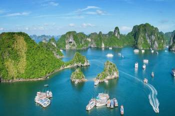 17D/16N
17 Days Package Tour Indochina Panorama
Hanoi - Ho Chi Minh City - Siem Reap - Luang Prabang - North Pole - Cantwell - Llan..
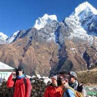 17D/16N
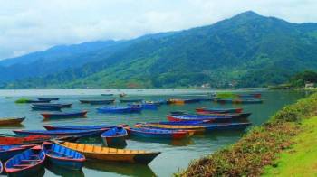 12D/11N
11 Nights - 12 Days Nepal Tour From Gora..
Prayagraj - Gorakhpur - Varanasi - Ayodhya - Kathmandu - Pokhara - Chitwan - janakpur
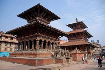 12D/11N
11 Nights - 12 Days Nepal Tour Package - 2
Prayagraj - Gorakhpur - Varanasi - Ayodhya - Kathmandu - Pokhara - Chitwan - janakpur
 12D/11N
11 Nights - 12 Days Nepal Tour From Gora..
Prayagraj - Gorakhpur - Varanasi - Ayodhya - Kathmandu - Pokhara - Chitwan - janakpur
 12D/11N
Prayagraj - Gorakhpur - Varanasi - Ayodhya - Kathmandu - Pokhara - Chitwan - janakpur
 11D/10N
10Night Himachal Pradesh Tour Ex - Shimla
Dalhousie - Khajjiar - Kufri - Manali - Shimla - Dharamshala - Amritsar - Mcleodganj
 11D/10N
Himachal Pradesh Tour Package 10 Night -..
Dalhousie - Khajjiar - Kufri - Manali - Shimla - Dharamshala - Amritsar - Mcleodganj
 11D/10N
Himachal Pradesh Tour Package 10 Night -..
Dalhousie - Khajjiar - Kufri - Manali - Shimla - Dharamshala - Amritsar - Mcleodganj
 10D/9N
9 Night - 10 Days Himachal Pradesh Tour ..
Dalhousie - Khajjiar - Kufri - Kullu - Manali - Shimla - Dharamshala - Amritsar - M..
 8D/7N
8D/7N
8D Kathmandu - Chitwan - Pokhara - Lumbi..
Kathmandu - Pokhara - Lumbini - Chitwan - janakpur