5 Nights / 6 Days
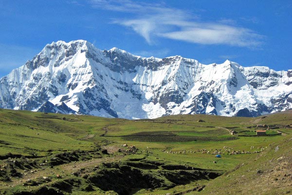
The Ausangate Trek is a six-day hike around the base of the enormous Mount Ausangate. It is the highest and most sacred mountain in southern Peru and for centuries has been central to the religious beliefs of the Andean people who still go on annual pilgrimages to its icy slopes.
The mountain’s snow-capped peak is 21,000 feet, or 6,385 meters, and although we will not climb up that far, we will get up-close and personal with the nature and the spectacular views that the region offers. While hiking completely around this mystical mountain, we will camp near hot springs and turquoise lakes inhabited by numerous bird species, including Andean geese and the almighty Andean Condor. We walk amongst herds of llamas and alpacas in remote native Quechua villages.
With spectacular glacial vistas, uninterrupted beauty and solitude, this is a spectacular trip for trekkers who love a true outdoor adventure.Sleeping bag (can be rented from us)
Day 1 breakfast and last day dinner
Tips for the crew (muleteers, chef and guide)
We set off early from Cusco travelling by private bus to the small village of Tinqui. We will see the impressive mountain range of Vilcanota and pass through several traditional Andean villages en route and take time to stop en route to take some photos. On arrival we meet our horseman and arrange our packs for the walk. We begin our walk through farming communities and enjoy the breathtaking views of the mountains. We will walk for around 3hrs and then its time for a lunch stop. After lunch we continue for another 2 hours approximately to reach Upis. There, we will have the opportunity to soak in the local hot springs before dinner, and camp for the night.
Lowest Elevation: 3800 m
Highest Elevation: 4400 m
Distance to walk: 12 km
Approximate walking time: 6-7 hours
Level of Difficulty: Easy
Upis – Puca Qocha After a big breakfast we are ready to leave our camp and get started on our hike for the day. We will climb to the high pass of Arapa (4850mts). From this vantage point we can see the contrast in landscapes – dry desert-like hills reach the glaciers of Mt. Ausangate, while below the valley is a bright green. If we are lucky we might even see a condor in the skies! We will enjoy the breathtaking snow capped views of Mt. Ausangate and PucaQocha. This area also boasts three beautiful lakes with tones of reds, greens, and turquoises (Pukacocha, Hatun Pukacocha, and Qomerqocha). Our second campsite is close to a glacier.
Lowest Elevation: 4400 m
Highest Elevation: 4850 m
Distance to walk: 12 km
Approximate walking time: 6-7 hours
Level of Difficulty: Challenging
Early morning after breakfast we will begin our ascent of approximately 2-3 hours over our second mountain pass, Abra de Apuchata (4,900mts). From here we descend for around an hour and a half towards our campsite at Ausangate Qocha where a delicious lunch to enjoy the breathtaking scenery. After our lunch we have our second ascent for two hours to our third mountain pass of Palomani (5,100mts), we descend into the small community of Huchuy Pinaya where we spend the night.
Lowest Elevation: 4600 m
Highest Elevation: 5200 m
Distance to walk: 13 km
Approximate walking time: 6-7 hours
Level of Difficulty: Challenging
Today we ascend to the highest point on our trek – Jampa (5,150mts). The silence of this remote wilderness is inspiring! From here we have an excellent view of Mount Tampa. After the pass we descend for 2 hours through an area of llamas, alpacas and vicunas to reach Pampacancha (4,050mts). From here we follow an uphill trail of approximately three hours that leads us to our campsite in Jampa (4,300mts).
Accommodation: Camping facilities
Maximum altitude: 5157mts
Walking distance: 11km approx
Difficulty: Challenge
After our walking and acclimatization on Day 4 – we are ready for another adventure! We take breakfast early and then begin our hike of approximately 1 hour to reach the glacier base and then to the top of the mountain! After enjoying the spectacular views of the Vilcanota range we descend back down to take a delicious lunch. In the afternoon we descend towards the Qomerqocha lagoon before arriving at Pacchanta after an approximated 5 hours walk. Pacchanta is a little community with attractive hot springs where we can enjoy a relaxing dip. We camp and spend the night here.
Lowest Elevation: 4250 m
Highest Elevation: 4500 m
Distance to walk: 13 km
Approximate walking time: 6-7 hours
Level of Difficulty: Moderate
In the morning we leave Pacchanta and start to walk back to the village of Tinqui – our trek takes approximately two hours. Once in Tinqui, we board our transportation that will take us back to the city of Cusco, where we estimate to arrive after nightfall.
Lowest Elevation: 3800 m
Highest Elevation: 4250 m
Distance to walk: 7 km
Approximate walking time: 3 hours
Level of Difficulty: Easy
Why Action Peru Treks and not just Peru treks? The word action requires physical movement, energy and accomplishes a purpose. Action Peru Treks provides superior, quality and authentic treks and tours to Machu Picchu and Choquequirao. We want you to connect with the treks and the beautiful scenery, which is why our team consists of only locals who have grown up on the land. Read More...
 4D/3N
4D/3N
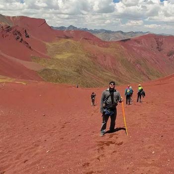
Vinicunca Rainbow Mountain - Ausangate T..
Cusco - Upis - Pucacocha - Surine Cocha
 2D/1N
2D/1N
 4D/3N
4D/3N
 1D/0N
1D/0N
 1D/0N
1D/0N
 1D/0N
1D/0N
 1D/0N
1D/0N
 2D/1N
2D/1N
 1D/0N
1D/0N
 6D/5N
6D/5N
 6D/5N
6D/5N
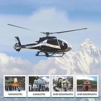
Chardham Yatra By Helicopter Tour
Yamunotri - Gangotri - Kedarnath - Badrinath
 6D/5N
6D/5N
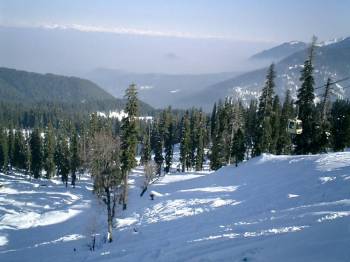
Srinagar,Pahalgam,Gulmarg,Sonamarg,Srina..
Srinagar - Pahalgam - Gulmarg - Sonamarg
 6D/5N
6D/5N
 6D/5N
6D/5N
 6D/5N
6D/5N
 6D/5N
6D/5N
 6D/5N
6D/5N
 6D/5N
6D/5N