6 Nights / 7 Days
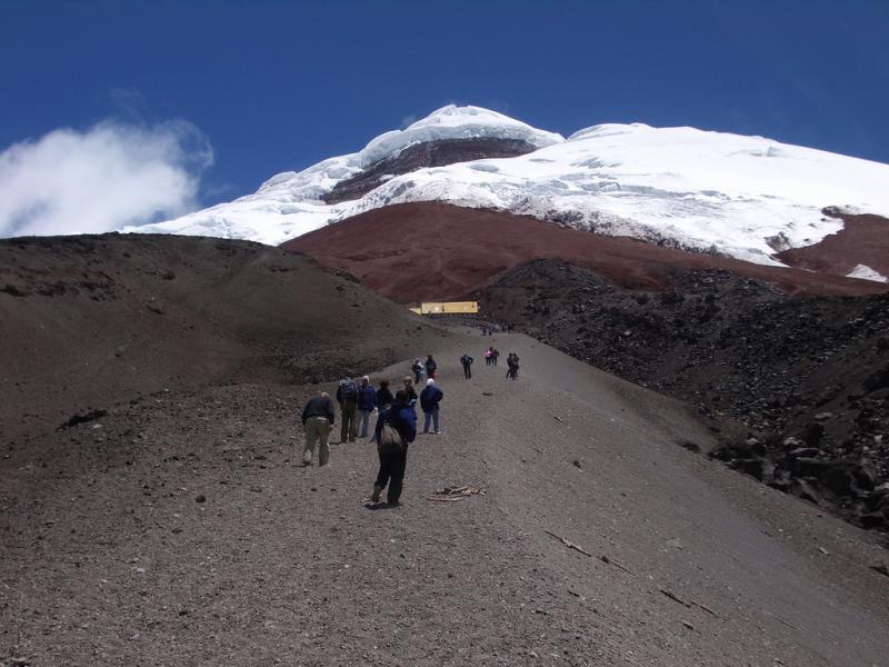
Cotopaxi is Considered Without a Doubt One of the Most Beautiful Peaks in the World.
It is the Most Popular Mountain of Ecuador and Due to the Fact It Has the Highest Number of Clear Days in Our Country, It is Perhaps the Most Frequently Climbed in all the Andes.
Often People Drive Into the Park, Climb the Mountain and Leave Again. But Cotopaxi and Its Surrounding Areas Offer Much More. The National Park Has Several other Smaller Volcanoes and Peaks that are Wonderful to Climb, and At the Same Time Offer Great Acclimatisation Opportunities.
So We Would like to Offer You Cotopaxi in a Different Way…
instead of the Normal Cotopaxi Climbing Tours with Drive in and Out, You Will Be Hiking. In this Way, Andeanface Offers You a Fantastic Chance to Enjoy and Experience Intensively the Beautiful Landscape Around the Mountain.
If You Would like to Get An Impression of this Unique Expedition, Then Watch the Movie Made By Andeanface Clients Anna & Robert Higgins: “cotopaxi Trek and Climb Expedition 2011.
After a Four Day Hike in Which We Climb Pasochoa 4.200 M /13,776 Ft, We Get Into Cotopaxi National Park. Once Within the Park We Hike Up to the Central Summit of Rumiñahui At 4.600 M / 15,088 Ft, Then have a Rest Day and Later Continue Towards the Jose Rivas Refuge At 4.800 M / 15,744 Ft. This Itinerary Has Proved to Be Very Effective for Acclimatisation.
It Provides the Best Chance to Summit Cotopaxi in a Short Period Whilst Minimising the Amount of Driving.International Flights.
travel Insurance.
accommodation and Meals While in Quito.
alcoholic Drinks.
extras, Laundry, Tips.
plastic Mountaineering Boots for Rent At $10 per Day
After a Short Drive of Only One Hour, We Start Hiking from the Village of Santa Clara Located in the Valley of Los Chillos At 2.750 M / 9,020 Ft. The Trek Follows Cobble Stone Roads On the Side of the Pita River, Which Comes from Cotopaxi National Park.
Close to the Hacienda Santa Rita We Pass in Front of a Shrine, Where Locals Come to Worship the "virgen De La Piedra", the Virgin of the Rock.
Today’s Hike Will Take Around 5 Hours. When You Get to the Hacienda the Camp Will Already Be Set Up. You Will Spend Your First Night At An Altitude of 3.280 M / 10,758 Ft.
Today We Leave in the Morning Around 8 A.m. For a 6 Hours Hike to the Pasochoa Volcano. We Will Be Crossing the Fields of Hacienda Santa Rita.
Pasochoa is An Ancient and Heavily Eroded Volcano that Has Been Inactive Since the Last Ice Age. If the Weather Permits, from the Summit, We Will Be Able to Take a Good Look At the Crater. Inside You Will See the Pasochoa Protected Forest Reserve, a Humid Andean Forest with More Than 110 Species of Birds and 45 Species of Trees, Located Between 2.700 M / 8,856 Ft and 4.200 M / 13,776 Ft. On a Sunny Day You Can Normally See Condors. We Return to Santa Rita Camp Site for the Night.
Today we hike towards the hacienda El Porvenir. Part of the hike goes through humid Andean Forest where there is a chance to see hummingbirds.
El Porvenir is one of the largest farms in Ecuador. It can be used as a base for excellent hikes within the Cotopaxi Park. Located at 3.600 m / 11,808 ft, El Porvenir is surrounded by four volcanoes: Cotopaxi, Sincholahua, Pasochoa and Rumiñahui. Here you will be able to enjoy your stay in a comfortable, functional and beautiful traditional Andean hacienda. The "casa de hacienda", or farmhouse, is built with materials such as brick, straw, wood and adobe that have been used for centuries. If Porvenir is not available we will use Hacienda Los Mortiños
From Hacienda El Porvenir We Start Hiking Towards the Central Ridge of Rumiñahui, Leading to the Middle Summit. The Rock On this Mountain Can Be a Bit Loose Underfoot, So We have to Take Care, But the Views from the Summit are Really Worth It. The Volcano is Located Only 13 Km North West of Cotopaxi and It is Named After Atahualpa’s General, Who Was the Last Inca Emperor. After the Emperor Was Murdered, Rumiñahui Led the Fight Against the Spanish Conquerors. In Quichua His Name Means "stone Face". We Spend the Night At Tambopaxi.
Today We Do a Gentle 2 Hours Hike to 5.000m On Cotopaxi to Increase Our Acclimatisation and to Do a Glacier School Sesion and Drive Down to Tambopaxi for the Night, It is a Beautiful New Hostel, Located Inside the Cotopaxi National Park. It is a Great Place to Rest and Acclimatise At the Same Time! It Has Excellent Facilities such as Good and Clean Showers, Including the Luxury of Warm Water, and the Food is Good.
From Tambopaxi We Drive the Short Distance to the Car Parking At 4.600 M / 15,088 Ft in Only 45 Minutes. From Here We Hike for Another 45 Minutes to the Jose Rivas Refuge At 4.800 M / 15,750 Ft. After Lunch, We Provide a Good Glacier Skill Review. Also We Will Brief You About all the Technical Aspects of the Ascent. After a Couple of Hours We Return to the Refuge for a Hearty Hot Meal.
This is the Day in Which You Will Actually Be Climbing Cotopaxi. We Leave the Refuge Around 1 A.m. For a Six Hours Climb. From the Hut We Ascend Moderate Glacier Slopes to the Summit. Along the Way However, Complex Crevasse Patterns and Snow Bridge Crossings Over Crevasses Will Make the Climb Very Interesting. After Passing Through a Heavily Crevassed Area, We Reach the Final Summit Slope. Here a Challenging Section of 35-40 Degree Snow Leads to the Abrupt Finish of the Climb On the Crater Rim of the World's Highest Active Volcano.
At the Top of Cotopaxi You Can Look Inside the Crater and See Its Sulphur Fumaroles. The Crater Rim Measures Approximately 800 M / 2,600 Ft in Diameter. The View from the Summit is Indeed One of the Most Spectacular in Ecuador.
Technically the Normal Route is Not Difficult, But Special Care Has to Be Given to Potential Hidden Crevasses. The Descent Usually Takes Around Two Hours.
We are Dealing in Tour & Travels Services. Read More...
 3D/2N
3D/2N
 3D/2N
3D/2N
 1D/0N
1D/0N
 1D/0N
1D/0N
 1D/0N
1D/0N
 1D/0N
1D/0N
Barra de Santiago - California - Galapagos - San Cristobal - Isabela - Floreana - F..
 1D/0N
1D/0N
 1D/0N
1D/0N
 1D/0N
1D/0N
 7D/6N
7D/6N
 7D/6N
7D/6N
Amritsar Chandigarh Delhi Agra Family Pa..
New Delhi - Agra - Vrindavan - Mathura - Amritsar
 7D/6N
7D/6N
 7D/6N
7D/6N
 7D/6N
7D/6N
Golden Triangle - East India Tour
Kolkata - Puri - Imphal - Agartala - Dimapur
 7D/6N
7D/6N
 7D/6N
7D/6N
 7D/6N
7D/6N
 7D/6N
7D/6N
 7D/6N
7D/6N
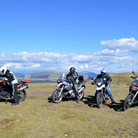
Best of Transylvania - Motorcycle Tour
Turda - Alba Iulia - Brasov - Bistrita - Baia Mare - Sugag (Transalpina Highway) - ..
 9D/8N
9D/8N
 11D/10N
Iquitos - Cotopaxi - Cayambe - Otavalo - Rucu Pichincha - Pasochoa
 1D/0N
1D/0N
 11D/10N
From the Inca Empire to the Peruvian Ama..
Colima - Perugia - Mohandessin - Cusco - Iquitos - MACHU PICCHU
 9D/8N
9D/8N
 7D/6N
7D/6N
 1D/0N
1D/0N