10 Nights / 11 Days
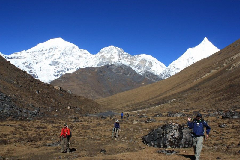
Bhutan’s premier trek, the Jomolhari trek is undoubtedly the pinnacle of Bhutanese trekking not just for locals but tourists all over the world, taking you to the most sacred mountain in the kingdom. Trekkers go to the base of Mt. Jumolhari and beyond, on the border of Bhutan and the Tibet region of China. Jumolhari Trek is the most popular trekking route in Bhutan and offers a wide range of landscapes, fauna and flora. Some cultural sightseeing will be possible as you head back to Paro for your departure.
after the trek and as
Tour Highlights
Trekking along one of the most scenic and popular routes in line with some of the worlds high unclimbed peaks in Bhutan.
Pristine, pure & beautiful lakes.
Lest trodden trails, picnic lunch, open camping in nature & family like trekking crew with lovable trekking horse and mule.
Pristine environment with rich flora and fauna. Encountering yak herders, interacting with them, and visiting their campsites and more.
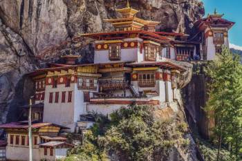
Hike to the holiest temple of the country, Taksang Lhakhang (Tiger’s Nest).
Trip Facts
Best Time: April - June, Sept. - Nov.
Activities: Trekking, camping, Culture
Highest Altitude: 4942m
Trek Grade: Moderate to Hard.
Avg. walking Distance: 17km
Avg. walking time: 6 Hours
Group size: 1 or more
Accommodation: Camping on trek & Hotel in cities
Meals on Trek: Breakfast, picnic Lunch, Dinner & Tea with snacks
Fly into Paro Valley on our national airlines, Drukair or the Bhutan Airlines. In clear weather, you can witness magnificent views of the world’s highest peak. The first gift from Bhutan will be the cool, clean fresh air as you step out of the plane – a befitting introduction to the spectacular beauty of Bhutan. Our guide and driver will receive you with warm well come and lead you around on your Bhutan tour. Relax and enjoy the beauty of Bhutan as you proceed away from the airport for some sightseeing in Paro. Explore Paro town and getting yourself introduced to the first Bhutanese town. Drive to Tadzong and visit the National Museum. later walk down to visit Paro Rinpong Dzong. If time permits visit one of the holiest temples in Bhutan, Dungtse Lhakhang, built in 1421 by the famous Tibetan Lama, Thangton Gyelpo and Kyichu Lhakhang, built in 659 AD.
Distance: 6.5 km (Round trip)
Time: 3 to 5 hours
Altitude: 3100m
After breakfast, embark on an acclimatization hike to Taktsang or the Tiger’s Nest, Bhutan’s most famous monastery. Start by driving to the base for 20 minutes and then hike up to the monastery at 3100m. The trail leads through forests of pine, Mountain oak, fir and hemlock with the amazing views of Paro valley below. About the half way you will reach a flat portion marked with a prayer wheel. Little further there is a Cafeteria with wonderful view of Tiger Nest. Continue further up till the look-out point from where you can see the whole monastery – it’s a good opportunity for a photography. The walk from the look-out point is down through the stony steps to the small water fall and then finally to the monastery. After paying visit, you will return to the cafeteria for a lunch. Then walk to the base where your car will be waiting for you. Take a finale look back to the monastery and enjoy a sense of jubilation and satisfaction. Overnight at hotel in Paro.
Distance: 15km
Time: 5-6 hours
Ascent: 300M
Descent: 0m
Camp Alt: 2870M
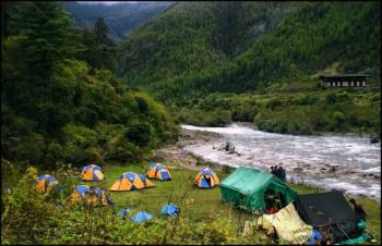
You will drive 12km north of Paro valley from your hotel to the trek start point at the historic Drugyel Dzong (Rebuilt) (2580m). Your trekking crew will be waiting here for you. After a brief meeting, you will walk downhill on a wide trail following the Pachhu (river), which then climbs gently traversing through well-maintained rice terraces and fields of millet. Soon the valley widens and the route enters an area of apple orchards, traditional farmhouses and the tiny settlements of Mitshi Zampa and Sangatan. You reach the army post of Gunitsawa at 2,810 after walking for a while through blue pine forest. Here your trekking permit will be checked and stamped. You will then cross Pachu River on a wooden bridge and then climb to Sharna Zampa at 2,870m. Just beyond Sharna Zampa, there are several meadows surrounded by trees where you will camp for tonight.
Distance: 22km
Time: 6-8hr
Ascent: 900m
Descent: 0m
Camp Alt: 3750M
This is a hard day as the altitude gain is above the limit. You will come across the first bridge enroute from Tibet to Bhutan that was used by the travellers once upon a time. The trail climbs steadily through beautiful thick forest consisting mainly of, Oak, Rhododendron, Bamboo, Fern, Birch, Fir, Larch, Maple and Blue Pine. The route has lots of small rises and drops with a vision of amazing snow-capped Jhomolhari on the north. The hard day of walking comes to an end at Soi Thangthanka camp, which is in a big meadow.
Distance: 15km
Time: 4-6hr
Ascent: 469m
Descent: 0m
Camp Alt: 4040m
The view of Jhomolhari fades away as you leave the camp inflowing forest on the way towards the Army camp. Late in spring, Blue Poppy (Bhutan’s national flower) has been spotted. The Military camp has Bhutanese and Indian army personnel guarding another pass to Tibet. The trail takes you through some remote villages and you might be invited into one of the houses for a cup of famous butter tea. After crossing the settlements, the summits of spiky peak Jitchu Drakey, Tshering Kang and Jhomolhari appear to get closer. Cross a bridge and suddenly the irresistible snow-and-ice- covered east face of Jhomolhari appears, with its massive 3200m- high wall of granite, marble, and quartzite. You have reached Jhomolhari camp.
Rest day at Jhomolhari camp will help with acclimatisation as most people will feel the effects of ascending 1800m in three days. There are some good day hikes from the camp, and it is important to hike so that you will acclimatise. Follow the standard trek rule: trek high, sleep low.
Distance: 21km
Time: 5-6hr
Ascent: 845m
Descent: 880m
Camp Alt: 4010m
It is a long climb to reach the first high and very windy pass of this trek, Nyile La pass (4830m). From the pass, you can get the views of overpowering mountains covered with snow, Jomolhari (7314m), Jichu Dakey (6989m) and Tshrim Gang (6789m). The route descends from the pass leading to a viewing point from which Lingshi Dzong can be seen in its full glory; a powerful, solitary structure in the middle of an enormous wilderness. Further descend, you reach Lingshi camp. You can walk around Lingshi village and visit the Dzong.
Distance: 19km
Time: 7-8 hrs
Ascent: 940m
Descent: 920m
Camp Alt: 4100m
The Laya-Gasa route leaves the Jumolhari trek here. The trek route climbs towards a small white Chorten on a ridge above the camp, then turns south up the deep Mo Chhu valley. The trail stays on the west side of the largely treeless valley, climbing steadily a short distance above Mo Chhu. It then crosses the river, and climbs steeply for two hours to Yali La pass (4942m). From the pass, on a clear day, you can see Jumolhari, Gangchen Ta, Tsherim Gang and Masang Gang. Descend alongside a stream to a shelter, and then further downstream to a camp at Shodu (4100m), a meadow with a Chorten.
Distance: 16KM
Time: 5-6 hrs
Ascent: 250m
Descent: 670m
Camp. Alt: 3600M
At this place, one comes back to the tree line. The path follows Thimphu River, descending through rhododendron, juniper and other alpine forests. The view of the cliff facing rocks and waterfalls is stunning. Hot lunch will be served by the riverside. After lunch the trail gradually ascends to the ruins of Barshong Dzong. This is a base from where it used to be supplying essentials to Lingzhi Dzong in olden days. You will camp in Barshong at an altitude of 3600m.
Distance: 17Km
Time: 4-5 hrs200M
Ascent: 200m
Descent: 280m
After a breakfast at the camp, you will start your hike first through the gradual ascent till you reach at the farm road. Walk through the farm road and make a detour descending gently through a dense forest of rhododendron, birch and conifers, and then drops steeply to meet Thimphu Chhu river. The trail stays on the left side of river, climbing over ridges and descending to side streams. Then the trail goes in and out steeply to the river and follows it southward to Dodena, elevation 2600m where you will be picked up by Lonely Bhutan Trekking transport and drive to Paro.
Drive to the airport for departure. Have a pleasant flight back home. Goodbye!
We deal in Tour Operator Services. Read More...

 12D/11N
 28D/27N
 16D/15N
 9D/8N
9D/8N
 6D/5N
6D/5N
 3D/2N
3D/2N
 10D/9N
 10D/9N
 11D/10N
 11D/10N
 11D/10N
 11D/10N
Bhopal - Pachmarhi - Jabalpur - Gwalior - Chhatarpur - Tikamgarh - Umaria
 11D/10N
 11D/10N
 11D/10N
Best of Gujarat With Wildlife Tour
Ahmedabad - Bhavnagar - Diu - Junagadh - Rajkot - Bhuj - Jamnagar - Dwarka - Mumbai
 11D/10N
 11D/10N
 5D/4N
5D/4N
 7D/6N
7D/6N
6 Nights/ 7 Days - Bhutan Happiness Tour
Punakha - Bumthang - Paro - Thimphu - Phobjik
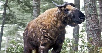 20D/19N
20 Days Land Package Country Tour BHUTAN..
Punakha - Paro - Phuntsholing - Bagdogra - Bumthang - Mongar - Trashigang - Trongsa..
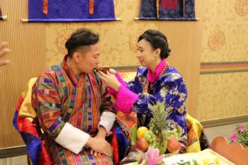 4D/3N
4D/3N
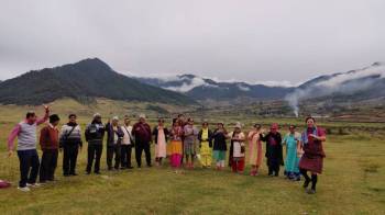 6D/5N
6D/5N
 7D/6N
7D/6N
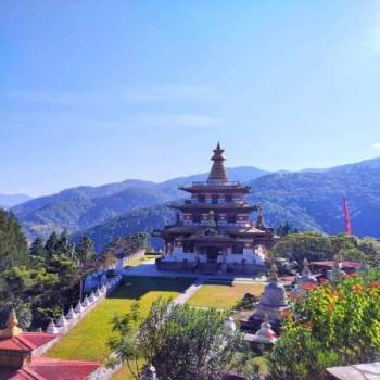 7D/6N
7D/6N
Rimso 7 Days 6 Nights Bountiful Tour fo..
Thimphu - Punakha - Paro - Phuentsholing
 7D/6N
7D/6N
 7D/6N
7D/6N